Date:
2017-01-18
2017-01-18
Size:
20631552
Category:
Navigation
Navigation
OS:
iOS
iOS
Price:
4.990
4.990
Compatible:
iPhone iPad
iPhone iPad
Requirements:
Version:
1.0
1.0
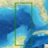
Description - Whitsunday Islands NP GPS charts Navigator
.
If you are iPhone and iPad owner,you now can download Whitsunday Islands NP GPS charts Navigator for 4.990 from Apple Store. The application is supporting English language. It is a whopper, weighing in at 20631552, so make sure you have plenty of free space on your iOS device. It is highly advisable to have the latest app version installed so that you don`t miss out on the fresh new features and improvements. The current app version 1.0 has been released on 2017-01-18.
More Info: Find more info about Whitsunday Islands NP GPS charts Navigator in Flytomap`s Official Website : http://www.flytomap.com
More Info: Find more info about Whitsunday Islands NP GPS charts Navigator in Flytomap`s Official Website : http://www.flytomap.com
Whitsunday Islands coverage resident in the app. It works WITHOUT mobile coverage Worldwide Flytomap Charts available when connected, thanks to viewer.flytomap.com Worldwide Satellite images overlay on charts Worldwide Terrain features overlay on charts, thanks to ...