Marine Navigation - Germany - Inland Rivers / Canals - Marine/Nautical Charts By Bist LLC ( $24.99 ) GPS Marine Charts App offers access to charts covering Germany (derived from BSH(Bundesamt f r Seeschifffahrt und Hydrographie) data) with POI layers created from ENC charts. Only marine GPS app to have route assistance with ...
Marine Navigation - Denmark - Marine/Nautical Charts By Bist LLC ( $44.99 ) GPS Marine Charts App offers access to charts covering Denmark waters (derived from KMS/GST ( Kort & Matrikelstyrensen / Geodatastyrelsen (GST)data). Only marine GPS app to have route assistance with Voice Prompts for marine navigation. It ...
4
Marine Navigation - New Zealand - Marine / Nautical Charts By Bist LLC ( $14.99 ) GPS Marine Charts App offers access to charts covering New Zealand waters (derived from LINZ(Land Information New Zealand (LINZ) - Toit te whenua)data). Only marine GPS app to have route assistance with Voice Prompts for marine navigation. ...
5
Marine Navigation - Caribbean - Nautical / MarineCharts By Bist LLC ( $24.99 ) GPS Marine Charts App offers access to RNC charts covering Caribbean waters (incl. Nassau, Aruba, Cayman, Barbados etc.) with POI layers created from ENC charts. Only marine GPS app to have route assistance with Voice ...
6
MarineCharts By EarthNC ( $19.99 ) EarthNC Marine Charts delivers a complete chart plotter solution on your iPhone and iPad. No other app delivers the same ease of use, depth of data, and range of features. GREAT CHARTS full, seamless US ...
7
Vermont MarineCharts By VIDUR IT TECHNOLOGIES PRIVATE LIMITED ( 1.990 ) A nautical chart is a work area on which the navigator plots courses, ascertains positions, and views the relationship of the ship to the surrounding area. Raster Charts contain all critical corrections published in notices to ...
8
i-Boating:CAN+US MarineCharts By Bist LLC ( 199.99 ) This App offers access to Marine Charts for USA and Canada. Coverage includes NOAA marine vector charts,freshwater lake maps,USACE inland river maps (HD/1ft/3ft bathymetryincluded where available),charts derived from UKHO & CHS data. First marine GPS ...
9
Wisconsin MarineCharts By VIDUR IT TECHNOLOGIES PRIVATE LIMITED ( 1.99 ) A nautical chart is a work area on which the navigator plots courses, ascertains positions, and views the relationship of the ship to the surrounding area. Raster Charts contain all critical corrections published in notices to ...
10
MarineCharts New Zealand By EarthNC ( $14.99 ) New Zealand, Tonga, and Somoan Nautical Charts - now for just 14.99 EarthNC Marine Charts New Zealand delivers a complete chart plotter solution on your iPhone and iPad. No other app delivers the same ease of ...
11
Bahamas MarineCharts By EarthNC ( $34.99 ) Bahamas Charts - introductory price just 24.99. EarthNC Bahamas Marine Charts delivers a complete chart plotter solution on your iPhone and iPad. No other app delivers the same ease of use, depth of data, and range ...
12
MarineCharts Online By YANALA REDDY ( $0.99 ) High Quality Navigational charts with maximum details and zoom upto 18. Data directly live from Noaa servers. Features: - High Quality Tile Charts From NOAA - Detailed Zoom - Seamless raster view - Complete USA coverage - Universal app with Both ...
13
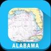
Alabama MarineCharts By VIDUR IT TECHNOLOGIES PRIVATE LIMITED ( 2.990 ) A nautical chart is a work area on which the navigator plots courses, ascertains positions, and views the relationship of the ship to the surrounding area. Raster Charts contain all critical corrections published in notices to ...
14
MarineCharts Brazil By EarthNC ( $14.99 ) EarthNC Marine Charts Brazil delivers a complete chart plotter solution on your iPhone and iPad. No other app delivers the same ease of use, depth of data, and range of features. Key Features: All Brazil Raster ...
15
eSeaChart - US MarineCharts By Sailport AB ( $7.99 ) eSeaChart is an easy to use marine navigation app. It uses the NOAA raster charts which has the same look as traditional paper charts and provide full coverage of the United States maritime territories. Fast and ...
Raster Charts Marine Charts App Offers Access
1
Marine US By GeoGarage ( $5.99 ) Marine US is an iPhone/iPad universal application which gives you access to all the catalogue of nautical raster charts for USA (from NOAA Hydrographic Service material) This is the alter ego app for sailing of the ...
2
Marine Argentine By GeoGarage ( $5.99 ) Marine Argentina is an iPhone/iPad universal application which gives you access to all the catalogue of nautical raster charts for Argentina (from SHN - Servicio de Hidrograf a Naval.) This is the alter ego app for ...
3
Marine NZ By GeoGarage ( $5.99 ) Marine NZ is an iPhone/iPad universal application which gives you access to all the catalogue of nautical raster charts for New Zealand (from Linz Hydrographic Service material) This is the alter ego app for sailing of ...
4
ReadyLift By Black Ink Media LLC ( Free ) Leveling Kits, Lift Kits, Block Kits, Off Road Suspension Kits, SST9000 Shocks - ReadyLIFT Suspension Inc. is the 1 preferred manufacturer of truck and SUV Suspension Leveling Kits and Lift Kits that are guaranteed to ...
5
Marine Bahamas WaveyLine By GeoGarage ( $29.99 ) Marine Bahamas is an iPhone/iPad universal application which gives you access to all the catalogue by Wavey Line Publishing (http://waveylinepublishing.com). This is the alter ego app for sailing of the Marine GeoGarage web portal : http://marine.geogarage.com One ...
6
Amnautical By American Nautical Services, Inc. ( Free ) Need to shop for nautical charts, nautical books, nautical instruments, flags, or marine supplies? Download our American Nautical store app and order the marine navigation supplies you need for your vessel today American Nautical carries ...
7
MarineCharts NOAA MGR By Mac George Roberts ( 1.990 ) Marine Charts app provides standardized nautical chart from NOAA Marine Charts app: Latest updated Charts App displays geo-referenced Charts Shows a single NOAA chart at multiple zoom levels. App provides a unified display of multiple charts. The charts are quilted together ...
8
SEAiq Open By Sakhalin ( Free ) SEAiq Open is the only marine charting app allowing you to use your own vector marine charts. Both S-57 (`ENC`) and CM93 formats are supported. SEAiq Open is fully usable for viewing your vector charts of ...
9
Marine Map Navigator By Mobile Map Solutions ( $9.99 ) Marine Map Navigator is an aid for marine navigation that integrates your iOS devices GPS data with vector electronic navigational chart (ENC). The application displays the ENC along with the position, heading and speed of ...
10
Kit Pics By Russell Kirk ( Free ) Inspired by a popular football podcast, Kit Pics takes you through the good, bad, and down right bizarre world of football kits. - Flick through the kits, rating each one as you go. - Check out the ...
11
Create Football Jersey By Joyonto Roy ( Free ) - Create your favorite teams jersey with your name and favorite number in no time. Save them in your phone and share on Facebook, twitter instantly. - Contains 16 teams jersey. Home kits are unlocked initially. ...
12
nv charts US By NV Verlag ( Free ) nv charts app is an ideal tool to navigate on mobile devices with the popular nv charts marine boating cartography. nv charts intuitive marine navigation app provides dynamic navigation experience using all tools and seamless chart display ...
13
SEAiq By Sakhalin, LLC ( 49.990 ) SEAiq is a full-featured marine navigation app. It is the only marine navigation app that allows you to load your own charts in a variety of standard formats, including: S-57, S-63, iENC, BSB, and KAP. It ...
14
3M Marine Gulf By Trix Communication (L.L.C) ( Free ) The 3M Marine Mobile App is an app designed for owners, fans and marine enthusiasts. It provides convenient access to a variety of marine information at the user's fingertips. Features: Easily scroll through the entire listing of boat ...
15
Seawell USA MarineCharts GPS By Seawell Software Private Limited ( 1.99 ) Seawell marine navigation apps provide maps to make life easier and more enjoyable for sailors, fishermen, divers, boaters and cruisers.. Ability to Zoom and Pan : Our ZAP has a new feature for intuitive waypoint and ...