Charts Maps Offline iOS Apps

Best Apps Navigation System Offline Maps

1
iLondon(Offline GPS+ Offline Maps+ Transport Maps&Airport Maps+ Travel Guide)
By Chao Zhang ( $0.99 )
London Calling? This pulsating megalopolis isn`t known as the World`s Capital for no reason: all corners of the globe meet here, producing a cosmopolitan cocktail that still tastes distinctly British. If a travel guide doesn t ...
2
Offline Maps from Open Street Maps, Cycle Maps or the maps provided by Google and Bing
By Damian Plak ( $0.99 )
Browse the most detailed Open Source maps or Google`s online maps, all powered by the fastest map rendering engine out there Get accurate directions, search for nearby venues, or make use of the offline maps. - ...
3
i-Boating: GPS Nautical / Marine Charts - offline sea, lake & river navigation maps for fishing & sailing
By Bist LLC ( Free )
This App offers access to NOAA marine vector charts, freshwater lake maps, USACE inland river maps (HD/1ft/3ft bathymetry included where available). First marine GPS app to have route assistance with Voice Prompts for marine navigation. ...
4
Offline Maps - for Google Maps with Offline Search
By Huirong Li ( Free )
Free for a very limited time Download now Offline Maps is the only App that includes offline maps & offline search together for Google Maps in the App Store. Features: - Very detailed maps even 3D buildings. - Offline ...
5
Airmap - Maps and Charts
By Biographics Consultoria E design Ltda Epp ( 0.99 )
Maps and Charts Aviation Charts - WAC and digital ROTAER for Brazil This app shows your position on a WAC map besides showing airports, heliports and fixed positions. It contains all ROTAER information (attention: database update requires ...
6
Nautical Charts & Maps
By LW Brands, LLC ( Free )
Main Features Include: NOAA Raster Nautical Charts (RNC) NOAA Weather Map Overlays NOAA Weather Data Includes: NEXRAD HD Radar Sea Surface Temperature Significant Wave Height Wind Speed & Direction Air Temperature 12-Hour Rain Probability -- IMPORTANT -- NOAA ...
7
Assimilate - Org Charts and Relationship Maps
By Assimilate Software Ltd ( Free )
Assimilate helps you create beautiful org charts and relationship maps with speed and ease. No drawing or dragging shapes required. Assimilate is automatic and intelligent. Step 1: Simply import contacts from your device. Step 2: Follow the ...
8
Brazzaville, Congo Offline GPS Navigation & Maps (Maps updated v.6119)
By Siarhei Zaturanau ( 12.990 )
Brazzaville, Congo Offline GPS Navigation & Maps offers the proven quality of best gps navigation system developed by Mad Map . It s the ultimate offline car navigation system and map orientation tool for your mobile ...
9
UK Cycle Maps – offline maps for urban and rural cycling routes
UK Cycle Mapsoffline maps for urban and rural cycling routes
By Zaia Design ( $0.99 )
Unlimited download of offline cycle maps for major cities and counties in the UK 100s of maps are available and all maps are free to download. F E A T U R E S - Unlimited Downloads ...
10
East Timor Offline GPS Navigation & Maps (Maps updated v.51519)
By Siarhei Zaturanau ( 12.990 )
East Timor Offline GPS Navigation & Maps offers the proven quality of best gps navigation system developed by Mad Map . It s the ultimate offline car navigation system and map orientation tool for your mobile ...
11
Taiwan Offline GPS Navigation & Maps (Maps updated v.6148)
By Siarhei Zaturanau ( 12.990 )
Taiwan Offline GPS Navigation & Maps offers the proven quality of best gps navigation system developed by Mad Map . It s the ultimate offline car navigation system and map orientation tool for your mobile device, ...
12
Kuwait Offline GPS Navigation & Maps (Maps updated v.52729)
By Siarhei Zaturanau ( 12.990 )
Kuwait Offline GPS Navigation & Maps offers the proven quality of best gps navigation system developed by Mad Map . It s the ultimate offline car navigation system and map orientation tool for your mobile device, ...
13
Good Maps - Google Maps Edition, with Offline Map, Directions and More
By dazuiba.me ( $0.99 )
Good Maps is the first (may be the only) app that bring Google Vector Maps, public transit directions and offline maps together Features: - Save maps for offline use. Google offline maps finally arrives in App Store. - ...
14
Venezuela Offline GPS Navigation & Maps (Maps updated v.611)
By Siarhei Zaturanau ( 12.990 )
Venezuela Offline GPS Navigation & Maps offers the proven quality of best gps navigation system developed by Mad Map . It s the ultimate offline car navigation system and map orientation tool for your mobile device, ...
15
Brunei Offline GPS Navigation & Maps (Maps updated v.61058)
By Siarhei Zaturanau ( 12.990 )
Brunei Offline GPS Navigation & Maps offers the proven quality of best gps navigation system developed by Mad Map . It s the ultimate offline car navigation system and map orientation tool for your mobile device, ...


Nautical Charts Navigation System

1
Belgium EnRoute Charts
By SendFreeFax.net ( $1.99 )
Belgium Enroute Charts app contain few moving maps of Belgium. All charts are moving maps with georeferenced. Features: All maps provided with this app. Location is displayed on the map with airplane icon. Maps are all offline viewing on ...
2
Japan EnRoute Charts
By SendFreeFax.net ( $1.99 )
Japan Enroute Charts contain Instrument Flight Rules (IFR) charts for entire Japan. Feature: Moving map of Japan EnRoute Charts Add custom markers for route planning on the map. All maps are provided free of charge. For support contact us at ...
3
Romania VFR Charts
Romania VFR Charts
By SendFreeFax.net ( $1.99 )
This app is moving map of Romania VFR Charts. All maps can be download offline for Offline viewing. Maps are smooth scrolling and supports adding custom markers for aiding navigation. Following 3 Romania VFR maps are ...
4
Europe High Altitude Enroute Charts
By SendFreeFax.net ( $1.99 )
Enroute charts for entire Western Europe. These are moving maps of Europe that include High Altitude Instrument Flight Rule (IFR) Charts. EUROCONTROL Regional Charts (ERC) combines Airspace Management Planning Charts (ASM) and the Central Flow Management ...
5
WX Charts USA - Aviation Weather Charts For USA
By S M Sidat ( $4.99 )
WX Charts USA for the iPad Now you can view & share your weather charts on the iPad. WX Charts USA presents various weather charts useful to pilots or anyone interested in flight planning. Synoptic charts ...
6
Seawell USA Marine Charts GPS
By Seawell Software Private Limited ( 1.99 )
Seawell marine navigation apps provide maps to make life easier and more enjoyable for sailors, fishermen, divers, boaters and cruisers.. Ability to Zoom and Pan : Our ZAP has a new feature for intuitive waypoint and ...
7
Marine Charts Offline: Florida West Coast
By YANALA REDDY ( 1.990 )
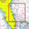
OFFLINE NAUTICAL CHARTS This App offers offline GPS nautical charts, marine navigation maps for fishing, kayaking, boating, yachting, diving, cruising & sailing. Chart Tiles are created from the latest available NOAA RNCs This app is most advanced with ...
8
WX Charts Europe
WX Charts Europe
By S M Sidat ( $1.99 )
WX Charts Europe presents various weather charts useful to pilots or anyone interested in flight planning. Three categories of charts are presented: Synoptic charts - 0600 to 1800 for the current day and forecasts up ...
9
WX Charts Europe iPad Edition
By S M Sidat ( $2.99 )
WX Charts Europe for the iPad Now you can view & share your weather charts on the iPad. WX Charts Europe presents various weather charts useful to pilots or anyone interested in flight planning. Three categories ...
10
GlobalFacts
GlobalFacts
By Csaba Boros ( $0.99 )
GlobalFacts contains not only all the information on economy, people, history, geography and government of more than 250 countries from the CIA World Factbook but it has the following exceptional features which make it to ...
11
Europe Enroute Charts Low Altitude
By SendFreeFax.net ( $1.99 )
Enroute Low Altitude charts for entire Western Europe. These are 13 moving maps of Europe that include Low Altitude Instrument Flight Rule (IFR) Charts. EUROCONTROL Regional Charts (ERC) combines Airspace Management Planning Charts (ASM) and the ...
12
Marine : Northeast Florida offline nautical chart
By YANALA REDDY ( 1.990 )
This App offers offline GPS nautical charts, marine navigation maps for fishing, kayaking, boating, yachting, diving, cruising & sailing. Chart Tiles are created from the latest available NOAA RNCs This app is most advanced with latest Nautical ...
13
Marine : Carolinas offline GPS nautical charts
By YANALA REDDY ( 2.990 )
This App offers offline GPS nautical charts, marine navigation maps for fishing, kayaking, boating, yachting, diving, cruising & sailing. Chart Tiles are created from the latest available NOAA RNCs This app is most advanced with latest Nautical ...
14
Marine: New York and New Jersey GPS nautical chart
By YANALA REDDY ( 1.990 )
This App offers offline GPS nautical charts, marine navigation maps for fishing, kayaking, boating, yachting, diving, cruising & sailing. Chart Tiles are created from the latest available NOAA RNCs This app is most advanced with latest Nautical ...
15
Terminal Area Charts
By SendFreeFax.net ( $1.99 )
Terminal Area Charts app provides Federal Aviation Administration (FAA) Visual Flight Rules (VFR) 1:250,000 scale moving maps for the United States. Terminal Area Charts that have an associated Flyway Chart now include that Flyway Charts. ...

Nautical Charts Navigation System